

|
~
|
 Earth Challenge: NO2 measurements from ultralight aircrafts Earth Challenge is a 27000 km expedition between Australia and Belgium, onboard 4 ultralight aircrafts, which took place in April and November 2009. The objective of the 7 pilots team, in cooperation with the World Wildlife Fund (WWF), was to draw the public's attention to the environmental problems such as sea rising, pollution and climate change. The project has been supported by BIRA-IASB. The UV-VIS DOAS group together with the mechanical workshop team, built a new remote-sensing instrument, namely the ULM-DOAS, which was installed onboard one of the aircraft. This instrument is primarily aimed to NO2 monitoring, but other chemical species are detectable, such as formaldehyde and sulfur dioxide.
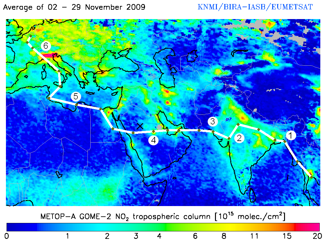
Flight tracks of the Earth Challenge expedition on a NO2 GOME-2 map. The numbers correspond to the places where the measurements were particularly interesting.
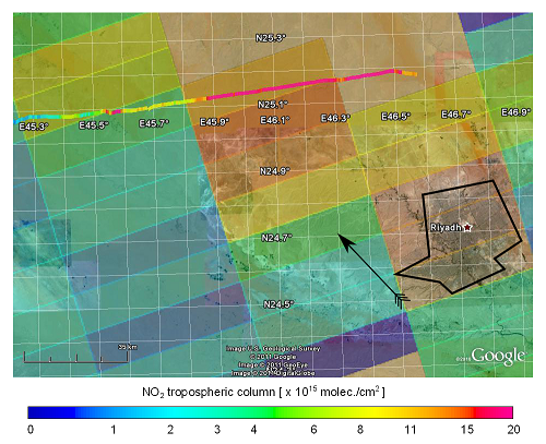
Example of result: Riyadh surrounding, with ULM-DOAS and OMI NO2 data superimposed. The arrow indicates the wind direction.
The slant columns measured by the ULM-DOAS are converted to vertical columns assuming a well-mixed boundary layer. In addition to Riyadh (shown above) ULM-DOAS and satellite (OMI and GOME-2) tropospheric NO2 columns could also be compared over Rajasthan (India) and the Po Valley (Italy). The highest columns were detected over Karachi, Pakistan. In Bengladesh, a large NO2 signal was observed downwind of the ship cemetery of Chittagong.
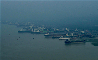
Ship cemetery of Chittagong (Bengladesh).
Publications Merlaud, A., Van Roozendael, M., van Gent, J., Fayt, C., Maes, J., Toledo-Fuentes, X., Ronveaux, O., and De Maziere, M.: DOAS measurements of NO2 from an ultralight aircraft during the Earth Challenge expedition, Atmospheric Measurement Techniques, 5, 2057-2068, 2012,doi:10.5194/amt-5-2057-2012 Alexis Merlaud, Caroline Fayt, Francois Vermeer: Earth Challenge: une aventure scientifique au service de l environnement, Science Connection, janvier 2010 (in Dutch: Earth Challenge, een menselijk avontuur voor het milieu) Links
Contact For more information, please contact : Alexis Merlaud, Caroline Fayt, or Michel Van Roozendael |

Last update on 09 Aug 2019