

|
~
|

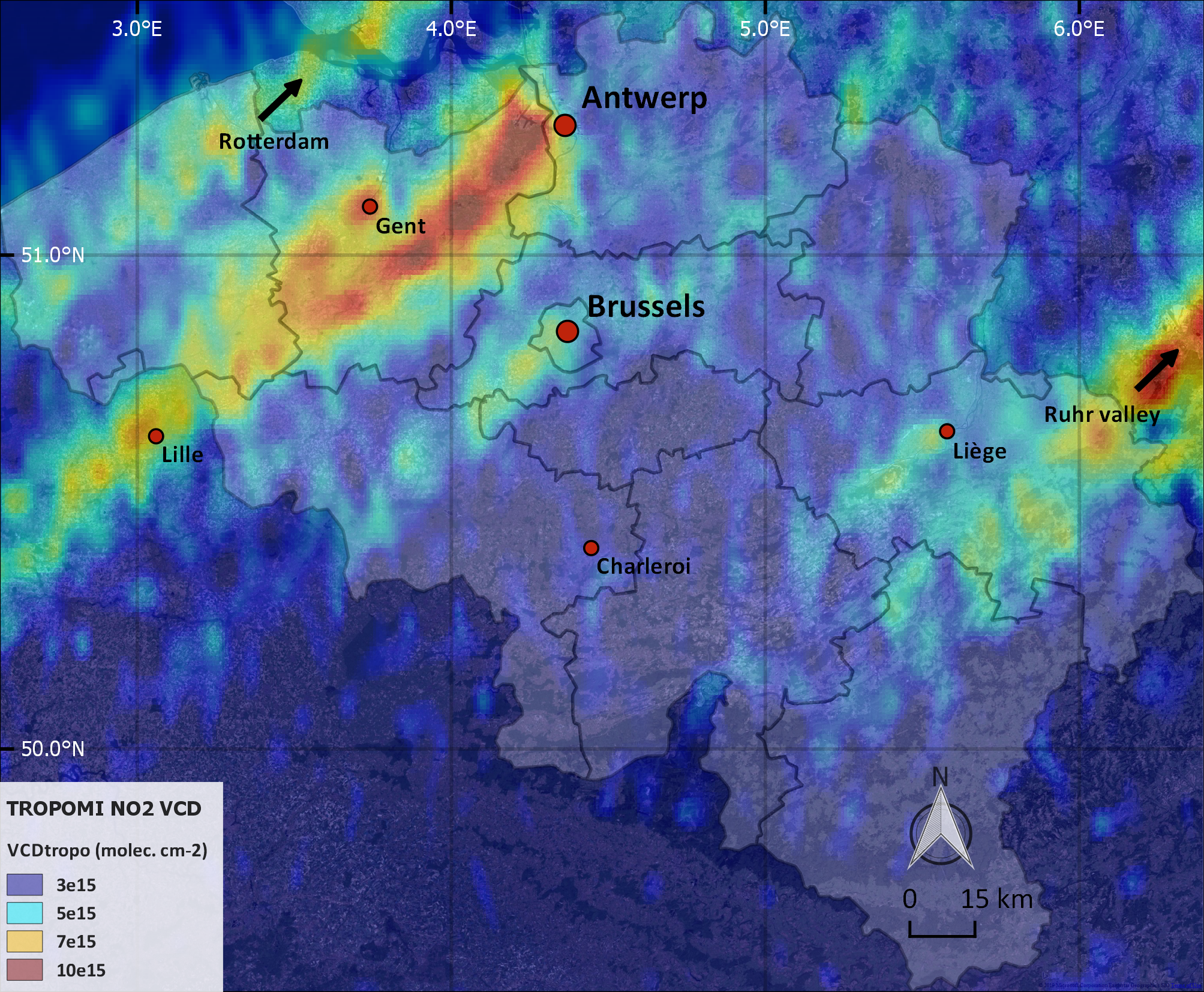
Figure 1: NO2 plumes over Belgium, as measured by S5-P/TROPOMI.
MAX-DOAS (Multiple-AXis Differential Optical Absorption Spectroscopy) is a recognized ground-based remote-sensing technique. It measures the amount of atmospheric trace gases absorbing in the UV-visible wavelength range of the solar spectrum by scanning the sky up and down from the horizon to the zenith and collecting the corresponding scattered sunlight. Since it provides measurements of key tropospheric pollutants at horizontal and vertical scales comparable to the resolution of nadir backscatter satellite sensors, this technique provides an ideal tool for validation. As a results, the number of MAX-DOAS sites has grown substantially over the last two decades, in support to satellite validation activities. The Fiducial Reference Measurements for ground-based DOAS Air-Quality Observations (FRM4DOAS) project was funded by ESA over the 2016-2018 period to develop and demonstrate a new centralized rapid delivery (24 hour latency) processing service for a selection of MAX-DOAS instruments. Also, in the scope of the project, guidelines and recommendations for instrument calibration and operation were established. FRM4DOAS team was coordinated at BIRA-IASB with as main partners the University of Bremen (Germany), the Royal Netherlands Meteorological Institute (The Netherlands), the University of Heidelberg (Germany), the Max Planck Institute for Chemistry (Germany), and BK Scientific (Germany).
As a follow-up of the activity (in the 2019-2021 time frame) it is planned to operationalize the system and to integrate it within the NDACC (Network for the Detection of Atmospheric Change) and EVDC (ESA Atmospheric Validation Data Centre) data hosting facilities. This implies a significant upscaling of a large number of stations (red circles in Figure 2). Moreover, additional air quality products will be progressively integrated, such as e.g. sulphur dioxide (SO2), tropospheric O3, glyoxal (CHOCHO), and aerosols. Links
Share this article |


Last update on 23 Aug 2019